Descrição
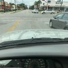
A manhole cover is so far below the surface of the street, it is essentially a pothole. Every driver that knows about it swerves to avoid it.
também perguntou...
Q. Is this near a bus stop?
A. [["COM_YesNo.No", "No"], ["COM_YesNo.Yes", "Yes"]]
A. [["COM_YesNo.No", "No"], ["COM_YesNo.Yes", "Yes"]]
Q. What type of surface is the street?
A. [["ROWM_StreetType.Asphalt", "Asphalt"], ["ROWM_StreetType.Brick", "Brick"], ["ROWM_StreetType.Concrete", "Concrete"], ["ROWM_StreetType.Unimproved", "Unimproved"], ["ROWM_StreetType.Unknown", "Unknown"]]
A. [["ROWM_StreetType.Asphalt", "Asphalt"], ["ROWM_StreetType.Brick", "Brick"], ["ROWM_StreetType.Concrete", "Concrete"], ["ROWM_StreetType.Unimproved", "Unimproved"], ["ROWM_StreetType.Unknown", "Unknown"]]


11 Comentários
Reconhecida City of Houston 311 (Oficial Verificado)
Encerradas City of Houston 311 (Oficial Verificado)
Case Completed
The CityWorks Service Request was closed by NEAL, KATRINA on2013-01-30T14:09:11.000-06:00
Reaberta Randy (Utilizador Registado)
City of Houston 311 (Utilizador Registado)
Randy (Utilizador Registado)
Thank you Chris. I appreciate the response. Here is some additional information...
The manhole cover is on S. Shepherd, in the right lane heading north about 30 feet past the Harold St intersection. It is next to the Honeybaked Ham store in the Randall's shopping center. Here is a link to Google Maps showing the manhole cover: http://goo.gl/maps/mRNuE
If there is any other information I can provide, please let me know.
Thanks again Chris.
City of Houston 311 (Utilizador Registado)
Craig Stone (Utilizador Registado)
Craig Stone (Utilizador Registado)
GeorgeJM (Utilizador Registado)
MCHouston (Utilizador Registado)
Randy (Utilizador Registado)